


In Denver, elevation is part of the city’s story. At exactly 5,280 feet above sea level, the Mile High City offers crisp air, wide-open skies and a one-of-a-kind sense of place you can feel the moment you arrive. That altitude shapes everything from architecture to outdoor adventures to the local sports scene.
In fact, the city’s elevation gives teams like the Denver Broncos a home-field advantage, as visiting athletes who aren’t accustomed to the elevation may tire more quickly. But even everyday activities come with a twist in the thinner air: Golf balls can travel about 10 percent farther, while alcoholic drinks may feel stronger than they would at sea level.
The sun, too, has a different intensity — with roughly 25 percent less atmospheric protection, it can feel warmer and more direct, making sunscreen a must year-round. Add to that Denver’s famously dry climate, and staying hydrated becomes essential. The upside? With less water vapor in the air, the sky truly does appear a deeper, more vivid blue — one more reason the Mile High City looks as striking as it feels.
Visitors can experience that mile-high distinction firsthand at the Colorado State Capitol, where the famous 13th step marks exactly one mile above sea level, a can’t-miss stop for photos. And it’s just one of several spots around the city that celebrate Denver’s signature elevation. Learn more about Denver’s mile-high status and discover more stop-worthy markers.
Why is Denver a Mile High?
A mile might not sound like much — it’s a distance many people run or walk without a second thought. But when that mile measures elevation, it tells a much bigger story. Denver sits on the western edge of the Great Plains, just east of the Rocky Mountains, where millions of years of geological activity lifted the land to its current height.
Researchers suggest that ancient tectonic forces — including water released from a subducted oceanic plate deep beneath the Earth’s surface — weakened the rock below, causing the region to slowly rise. This process helped elevate Denver and much of the surrounding Front Range. While the city center famously sits at 5,280 feet, elevation across the metro area actually ranges from about 5,130 to 5,690 feet, giving different neighborhoods their own subtle variations in altitude.
It’s a reminder that Denver’s mile-high status is the result of a long, dynamic geological journey.
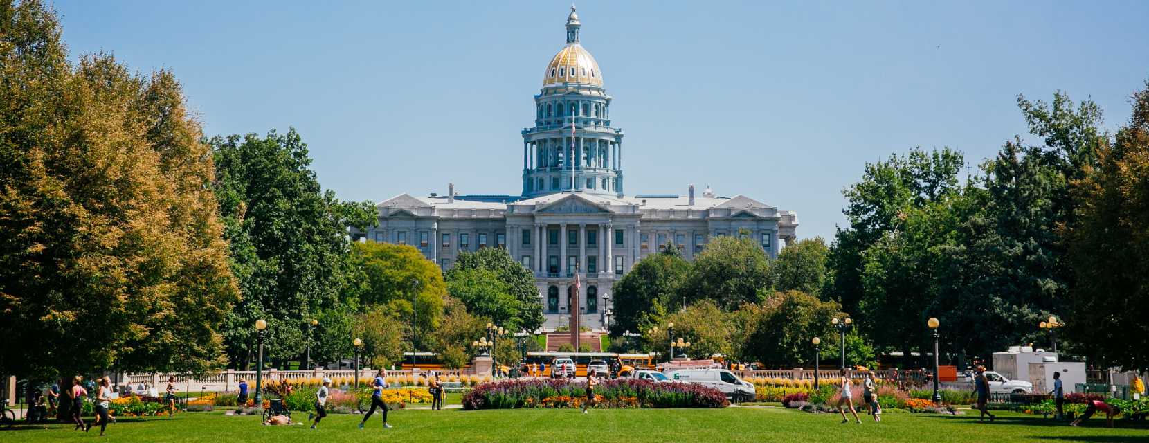
Colorado State Capitol Building
The Mystery of the Capitol Steps
Denver’s mile-high story doesn’t stop with geology — it’s also etched (and re-etched) into the steps of the Colorado State Capitol, one of the city’s most recognizable landmarks. While the building sits at roughly 5,280 feet above sea level, pinpointing the exact mile-high mark has been an evolving process for more than a century.
In 1909, students from the University of Denver made the first official measurement and placed a brass marker on the 15th step of the Capitol’s west entrance. That original marker didn’t last long — it was stolen multiple times over the years — prompting officials in 1947 to carve the words “One Mile Above Sea Level” directly into the granite to create a more permanent designation.
As technology improved, so did the accuracy of the measurements. In 1969, engineering students from Colorado State University recalculated the elevation and installed a new marker on a higher step. But even that proved slightly off. Finally, in 2003, students from Metropolitan State University of Denver used modern surveying tools to identify the true elevation, and in a dedication ceremony that same year, Gov. Bill Owens placed the official marker on the 13th step, where it remains today. The earlier markers are still visible, offering a unique, layered look at the city’s history.
Today, the Capitol steps are one of Denver’s most popular (and free) photo ops. Visitors can stop by anytime or join a free guided tour (Monday through Friday), which includes a 99-step climb to the dome for sweeping views.
Where Can I Find More Mile-High Markers in Denver?
Although the Capitol’s mile-high insignia is the best-known symbol, it’s far from the only place in Denver that celebrates the city’s famous elevation. Throughout town, you’ll find creative and unexpected ways the city puts its 5,280-foot status on display.
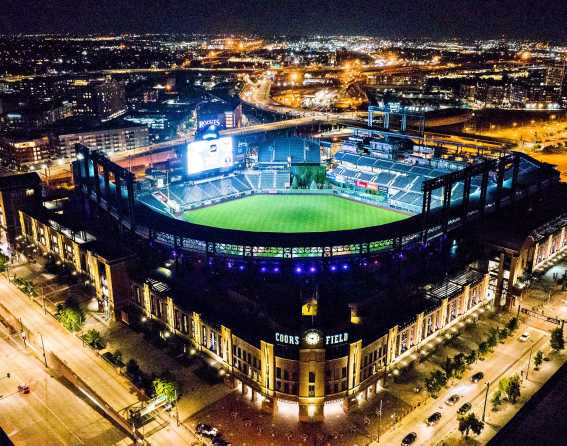
Coors Field
At Coors Field — home to MLB’s Colorado Rockies — keep an eye out for the row of 865 purple seats that wrap around the upper deck in the 300-level. They’re not just a bold design choice — they mark exactly one mile above sea level. You may be farther from the action on the field there (binoculars help!), but the views are expansive and the tickets are some of the most affordable in the stadium.
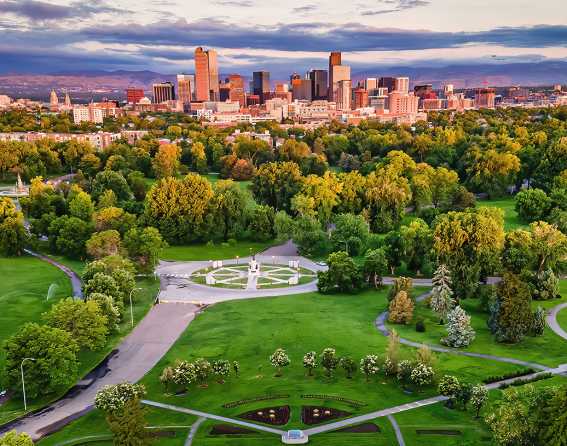
City Park
For a more active experience, head to City Park and follow the Mile High Loop Trail, a 3.1-mile route that traces the 5,280-foot contour. It’s a great way to log a full 5K at altitude while taking in some of Denver’s most scenic green spaces. Along the way, look for markers noting where you’ve hit the mile-high point, including spots near the Denver Zoo Conservation Alliance and just beyond East High School.
High Line Canal Trail
Another favorite for walkers, runners and cyclists, the High Line Canal Trail stretches an impressive 71 miles from Douglas County to near Denver International Airport. While it sits slightly above a mile high — between 5,410 and 5,542 feet — its history is rooted in Denver’s elevation.
Originally built in the 1800s as an irrigation system, the canal was designed to follow the land’s natural contours so water could flow by gravity alone, without pumps. That clever engineering explains the trail’s winding path, which today serves primarily as a recreational corridor, though portions still provide water to local farms.
Denver Museum of Nature & Science
For a mile-high moment with a view, make your way to the Anschutz Family Sky Terrace at the Denver Museum of Nature & Science, which sits right at 5,280 feet. After exploring the museum’s exhibits, head to Level 4 of the West Atrium and step outside for sweeping vistas of the Denver skyline framed by the Rocky Mountains.