


When you land at Denver International Airport, your mobile phone will automatically be on the Mountain time zone. They don't call them smartphones for nothing! And yet it took hundreds of years of history and scientific know-how to make this happen. But what is the Mountain time zone actually based on?
It turns out that an important reference point, the 105th meridian, runs right through the heart of Denver. And you can go out and "experience" this imaginary line and learn a little about cartography (map-making) and geodesy (mathematically measuring the Earth's shape).
A Brief History of Meridians
As people began traveling around the world, they needed a universal agreement on global reference points for timekeeping and navigation.
Shortly before Denver was founded in 1858, the Greenwich meridian, which passes through the Royal Observatory, Greenwich, in London, became the international standard prime meridian, a line of longitude running north and south to the poles. This marked the beginning of an international effort to coordinate all meridians, coupled with lines of latitude running east and west to pinpoint any point on the planet. Since scientists back in the day were using rudimentary instruments, modern satellite navigation is more closely aligned with the Earth's true center of mass. In other words, the old 1800s marking strip at the observatory is slightly off.
The 105th meridian serves as the reference point for the seventh time zone west of Greenwich. Depending upon the time of year, you subtract 6 or 7 hours from Coordinated Universal Time (UTC), which your smartphone does for you, to determine Mountain time. While this may sound straightforward enough, political sensitivities have created irregular time zone boundaries. But when you're in Denver, you can be certain you're in the center of this particular time zone.
Where to Find the 105th Meridian
By coincidence, the 105th meridian goes right through the center of Denver Union Station (39°45'11.47" N -105°00'0.33" W), the city's transportation hub, which also has great restaurants and outdoor patios. There is a steel bar embedded in the paving of Wynkoop Plaza in front of the station showing the meridian line as it enters the station. A display panel inside the west doors of Union Station provides a history of meridian lines and shows how they work in setting time zones. There's also a sculpture, "Meridian," on the plaza by artist Jim Sanborn.
Another place to "experience" the imaginary line is along Kalamath Street, where it runs straight north and south past West Colfax Avenue. It then extends to the Arctic Ocean and down through Mexico on its way to Antarctica.
While most of Denver's streets line up with the four cardinal points (north, south, east and west) of a compass, there is a deviation in Lower Downtown (LoDo), downtown and Five Points, where the streets turn 45 degrees and run parallel to the South Platte River. These are the oldest parts of what was once a mining boomtown. Some say this layout had to do with access to water.
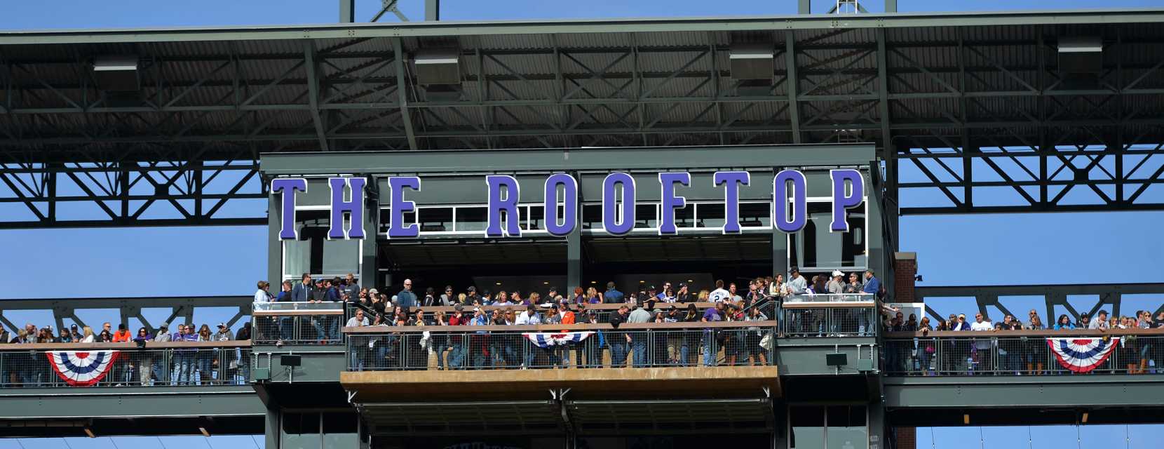
The Rooftop at Coors Field
Other Imaginary Lines
5,280 Feet Above Sea Level Contour Line
Denver has another imaginary line that is equally interesting — the contour that is exactly 5,280 feet above sea level with mile-high markers to boot. A contour line on a map joins points of equal elevation. Therefore, the contour line that is exactly one mile above sea level in Denver is not just one point, but actually passes through thousands of buildings as it winds its way around the city.
The most famous place the contour touches is the west steps of the Colorado State Capitol Building. The mile high contour also passes the mayor’s office, at several points near City Park and the contour continues down to Coors Field, where it passes through the Rooftop — the largest outdoor bar in any stadium in America. On a steel beam above the bar is a gigantic “5280,” indicating that the beam is exactly a mile above sea level. It's the perfect place to enjoy a Colorado craft beer and cheer on the mile-high Colorado Rockies.
Colorado's Jagged Border
Thanks to surveying errors in the 1800s, Colorado's border is far from a perfect rectangle. It's a 697-sided polygon. What's more, Congress defined Colorado as a geometric grid of latitude and longitude in 1876. Due to the Earth's curved surface, it's a trapezoid, where the southern border is 22 miles wider than the northern. Nonetheless, there are some incredibly cool things to see along Colorado's border, like national monuments and parks: Four Corners Monument, Mesa Verde National Park, Hovenweep National Monument and Colorado National Monument.